The Shortcut That Wasn't: Common Errors When Tracing Old Routes
Tracing old routes means comparing maps without mistaking straight lines or modern roads for proof. Learn which clues to check before drawing a route.
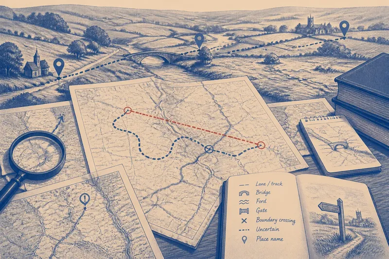
The common mistake in tracing old routes is to treat the straightest line between two places as the oldest path. That shortcut can erase the detours imposed by slopes, marshes, river crossings and county boundaries, leaving you with a neat line that explains little about how people actually travelled.
When tracing old routes, use maps as records of different moments, not as competing pictures of one fixed network. These errors are easy to make; each can be avoided by checking what a map can and cannot tell you before connecting its marks.
1. Treating a straight line as evidence of an old route
A straight line on a map may look convincing because it joins a market town, a bridge and a parish centre with little fuss. But the eye supplies the connection: the map may show separate features, not one continuous route. A drawn line can also result from simplification by the mapmaker or from a later road laid out for different purposes.
Start by asking whether the line appears as a continuous feature on the original map. Look for a consistent stroke, width or symbol, and check the map key. If the evidence is a ruler-straight alignment between named places, describe it as a possible corridor, not as an established road.
Then examine what lies between the endpoints. A route that crosses a steep valley, wet ground or an awkward bend in a river without any marked bridge or ford needs more explanation than a route following a usable crossing. Terrain does not prove that a path existed, but it can show where a proposed line would have faced a practical obstacle.
2. Assuming a modern road preserves the earlier way
Some current roads do follow older routes, but their present alignment is not proof of continuity. A road may have been widened, diverted around a village, straightened, or moved to reach a newer bridge. Conversely, a lane that looks minor today may preserve an older connection that a major road now bypasses.
Compare the road’s shape and connections across maps of different dates. Does the same bend recur? Does the road continue to the same ford, market, church or boundary crossing? A change in junctions or a new bridge can explain why a modern route departs from an earlier line. Record each map’s evidence separately before deciding whether the alignments are likely to be related.
Do not let road classification settle the question. A modern map may emphasise a main road and omit tracks; an older county map may show a minor way clearly but give less detail about its surface or use. The two maps may be showing different things rather than contradicting one another.
3. Joining disconnected map marks by eye
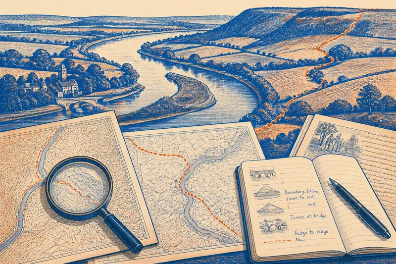
A path can disappear from one sheet at a field edge, then reappear on the next sheet near a bridge. It is tempting to join the marks with a smooth curve. Yet a gap may mean the route stopped, changed direction, crossed an unrecorded area or simply fell below the map’s level of detail.
Check the sheet edges, scale and adjoining maps before drawing a connection. Look for intermediate clues such as a lane name, a gate, a ford, a bridge, a parish boundary crossing or a track aligned with the marks. If the route remains uncertain, show the gap as uncertain rather than filling it with an unbroken line.
Imagine you find a faint track ending at a stream on one map and a lane beginning beyond it on another. If a later map marks a bridge at that crossing, you have a reason to investigate a possible connection, but not proof that both marks belonged to the same route. Keep the alternatives visible until another clue supports one reading.
4. Treating every map as an equally accurate record
Maps were made for particular users and purposes. A map drawn to show estates may emphasise property divisions; one made for travel may give more attention to roads and crossings. A local plan can show small features in detail while covering only a limited area. Differences in emphasis can make a route seem to appear or vanish when the map’s purpose has changed.
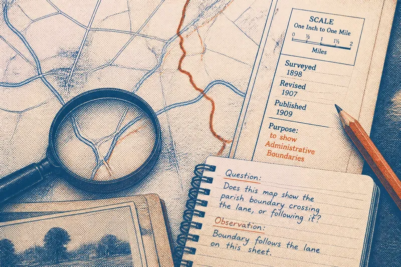
Before comparing route lines, note the map’s date, scale, coverage and stated purpose. Check whether the map is an original survey, a later copy or a reduced reproduction, if that information is available. A copied map may preserve an earlier depiction, but its publication date alone does not tell you when the route information was collected.
Keep the comparison fair: align maps using stable features such as a church, river junction or long-standing boundary, then check whether the proposed route still fits. If the sheets do not align closely, apparent shifts may come from the maps themselves rather than from a route being moved. Use the map’s own legend and catalogue notes where available; for map-specific dating or local access questions, follow the holding archive’s guidance.
5. Reading a county boundary as a travel barrier
A county line can divide a route on the page without having interrupted movement on the ground. Roads, tracks and crossings may link communities on either side, while the administrative line records a different kind of relationship. Equally, the fact that a route crosses a boundary does not show that it served as a major through-way.
Trace the route beyond the county edge using maps from the neighbouring county where possible. Check whether the road continues towards a settlement, crossing or market, and whether the map symbols remain comparable. A route that stops at the edge of your sheet may simply continue beyond its frame.
Notice where the boundary meets physical features. A county line that follows a river may coincide with a difficult crossing; one that cuts across open land may be easier to cross. Neither arrangement determines the route by itself. Treat the boundary as one clue among terrain, crossings and settlement links, rather than as an automatic barrier or guide.
6. Letting a place name decide the route
A name containing a word associated with roads, bridges, gates or crossings can point to a feature worth checking. It cannot, on its own, locate a route precisely or establish when that route was used. Names may shift, survive after a feature changes, or refer to something other than the route you have in mind.
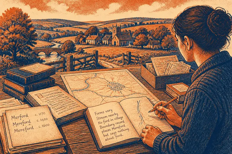
Map the name’s location across more than one source and see what sits nearby: a stream, old lane, boundary, bridge or settlement entrance. Check whether the form of the name changes between records. A label placed beside a road might identify a farm or field rather than the road itself, so keep the object of the name open until the map makes its placement clear.
Use names to generate questions, then test those questions against mapped features. If a name suggests a crossing but no crossing is shown, note the mismatch. Do not redraw the route to fit the name unless another map or local record supports that interpretation.
7. Mistaking a mapped route for proof of how people used it
A map can show a road or path without telling you who travelled it, how often it was used, or whether it remained passable through every season. The line may record an official way, a property access or a route that had already become less important. Route presence and route use are related questions, but they are not the same.
Where the distinction matters, compare map evidence with local records that address a different aspect of the route, such as parish or estate documents, road maintenance records, or descriptions of a bridge or ford. These records can add context, but their coverage may be uneven. A missing reference is not proof that the way did not exist.
Describe what each source actually supports. “A lane is marked on this map” is more precise than “this was the main route”, unless the maps or records provide a reason to make the broader claim. That restraint makes your account easier for another reader to check.
How should you compare old route clues?
Which map should you start with?
Start with the map that clearly covers the area and shows the features relevant to your question, rather than choosing the oldest sheet automatically. Note its date, scale, purpose and map key so you know what its omissions might mean.
How can you tell whether two marked roads are the same route?
Compare their alignment, endpoints, crossings and connections to settlements across maps, using stable landmarks to line the sheets up. A shared corridor is a useful clue, while changed bends or junctions may indicate a diversion or separate roads.
What should you do when a route disappears between maps?
Check neighbouring sheets and later or earlier maps for a bridge, ford, lane name or continuation beyond the frame. If the gap remains, mark the connection as uncertain instead of drawing a confident line through it.
Can a place name confirm an old road?
A place name can help identify an area for closer inspection, but it cannot confirm a road by itself. Look for a corresponding mapped feature or a local record that links the name to a route or crossing.
Keep the route line as cautious as the evidence
When tracing old routes, separate what is visible from what you infer. On a working copy, use one style for routes directly marked on a map and another for possible connections, and add a brief note naming the clue behind each uncertain segment. That simple distinction lets you compare routes without turning a plausible shortcut into a fact.
A good route reading does not need every gap filled. Leaving an unresolved crossing or doubtful alignment visible is useful: it tells you exactly which map, adjoining sheet or local record to examine next.